

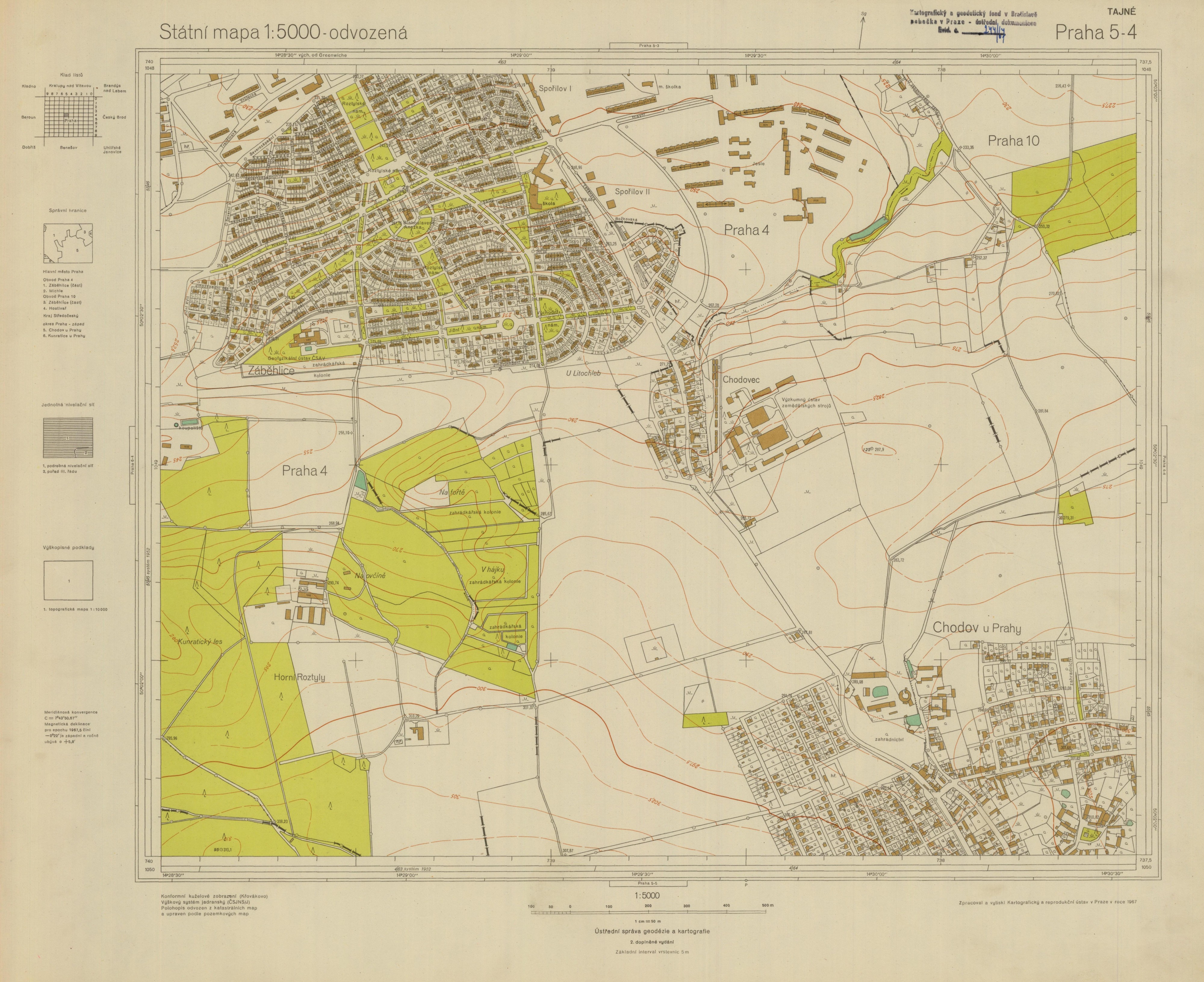
State Map 1:5000-derived - S-1952
| Product information | ||
|---|---|---|
 | Name | State Map 1:5000-derived - S-1952 |
| Commercial code | 638151 | |
| Export unit | SM 5 map sheet (2,5x2 km) | |
| Unit price | According to Regulation No 645/2004 Sb. | |
| Export formats | JPEG | |
| Coordinate systems | S-JTSK / Krovak East North | |
| Distribution | 

| |
| Product description | The second supplemented editon of the State Map 1:5 000-derived contained plane coordinate of Gauss-Krüger’s projection in the S-1952, which was secret. That is why these map sheets are arranged in separate collection in the Central Archives of Surveying, Mapping and Cadastre. The map frame contains scale lines of planimetric net of Křovák’s univers conform conic projection in a half-kilometer interval, scale lines of planimetric net in the S-1952 in a half-kilometer interval, scale lines of geographical net and its description. | |
| Update cycle - update state | After scanning of the whole data series the update is further terminated; it is an archival document that is not a subject of update. | |
| Conditions applying to access and use | According to Regulation No 645/2004 Sb. | |
| View data |
Web map application | |
| Data download |
Download of a demo file
| |
| Contact - product information | Land Survey Office, e-mail: ZU-obchod@cuzk.cz | |
Product last update:
2019-03-28
2019-03-28
Information last update:
2023-06-30
2023-06-30
 RSS 2.0 Geoportal ČÚZK